My First Bushwack
August 4, 2016 8:00 pmIf you are not familiar with the term, “bushwacking” refers to cross country or off trail hiking. The term explains a lot since you are at times literally whacking bushes out of your way. I had not previously done any bushwacking and I can’t say I was looking forward to it. I wasn’t so nervous about keeping my direction as I was apprehensive about getting through dense bush.
I had several tools I was prepared to use not to get lost and to reach my destination. I had the TransADK guidebook, the TransADK maps, a compass and the Google Maps GPS on my phone. Allthough it sounds like GPS might be a panacea for off trail navigation, it’s worth noting, that without a cell signal, while you can still get positioning information, it’s very basic and essentially just shows your direction on a big green square. It also shows bodies of water and even some small streams which can be very helpful. There are also battery concerns or technical failure to keep in mind. Certainly not a perfect solution. It was one more tool in the set though and I was greatful for it.
The guidebook had a pretty thorough description of where to begin and where to head to from there. There were 3 bushwacks today. 2 relatively short ones and one to the summit of a Mountain. As I reached the area of woods I was supposed to enter, I put on my gaiters, took a deep breath and plunged into the woods.l trailess for the very first time.
It was definitely a little awkward for someone who was used to trail travel. As I had expected dense areas of spruce were the most difficult to move through, with their hundreds of branches and thousands of tiny needles that always seemed to grow right to the forest floor. One of the most notable differences almost immediately was the amount of effort needed to cover such short distances. I was certainly getting a workout over less than challenging inclines or at times even small downhills. I pressed forward trying to avoid the densest brush while working to maintain my course through the woods. I navigated keeping the direction I had when entering with the west to my right and south in front of me and using my compass for course corrections. Occasionally I would pull out my phone and pop open the GPS for a quick look to confirm I was making the correct decisions. I was spot on and having no directional issues.
I certainly didn’t enjoy it, and was not looking forward to more of the same but after about 1.5-2 hrs I successfully found the snow mobile trail in was supposed to connect with. I felt at least i had some confidence in my ability to complete the task even if not take pleasure in it.
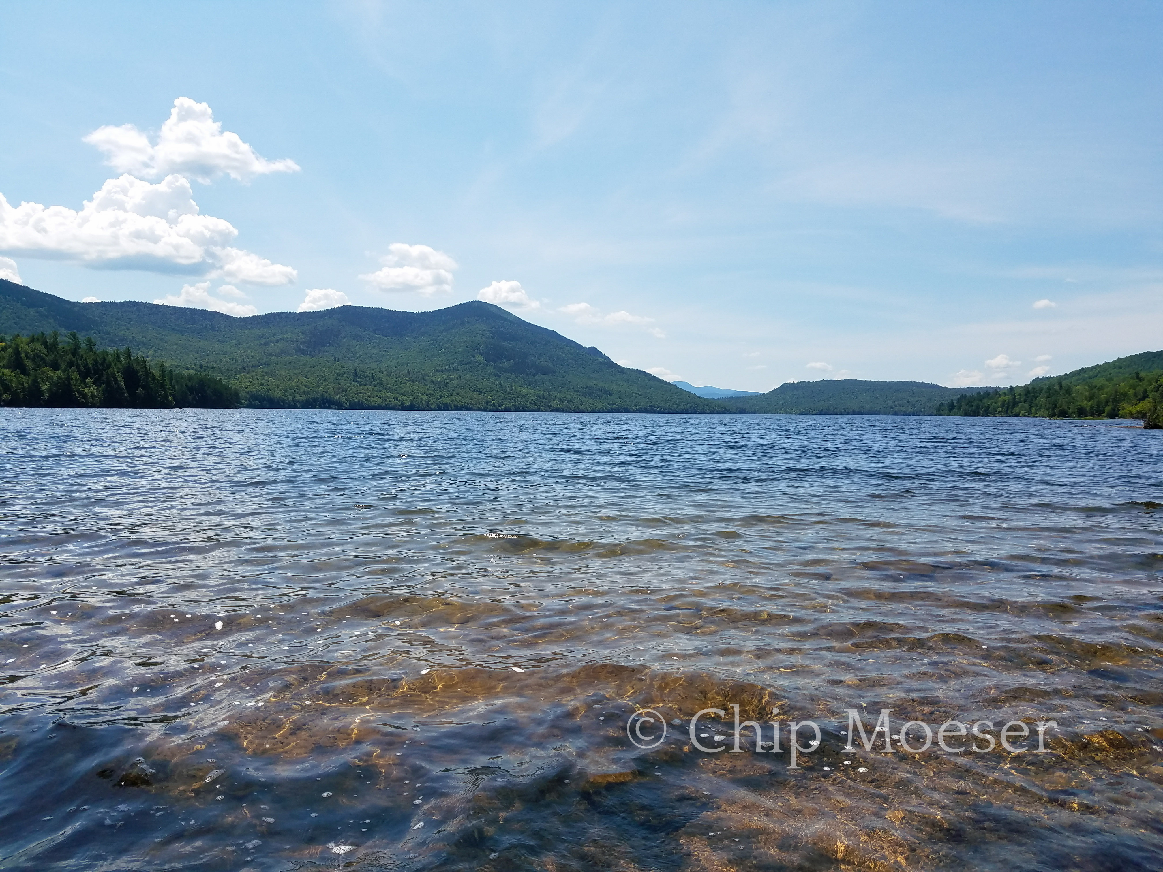
The snow mobile trails were a bit of a maze and had no directional signs but were navigable. I made a short wrong turn or two, never loosing more than two minutes in the wrong direction and even once coming out shore side of Taylor Pond with my first views of the High Peaks including the distance and Catamount the mountain I was to summit later on the shore across the pond. The views were just spectacular and I was excited and filled with anticipation of the hike ahead.