Zero Day
July 2, 2010 12:39 pmA day when a hiker walks no miles. A day of rest.
Best spent hold up in a hiker hostel or hotel watching World Cup Soccer 🙂
A day when a hiker walks no miles. A day of rest.
Best spent hold up in a hiker hostel or hotel watching World Cup Soccer 🙂
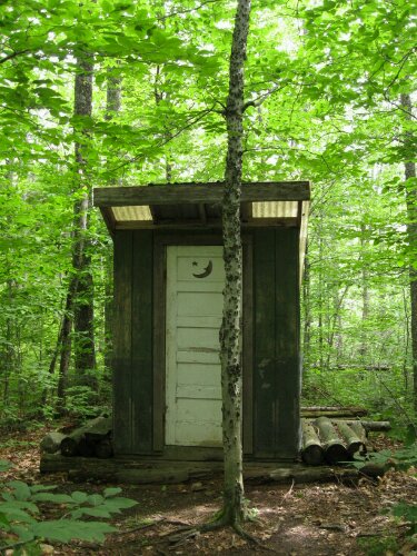
Outhouse. Not wild about these but it beats digging a cathole. This one had 2 seats in it. Not sure I understood that.
Date: 7.1.2010
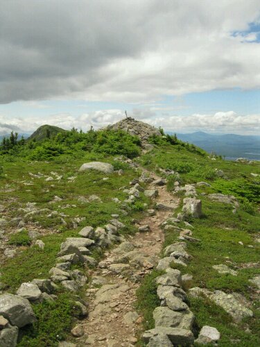
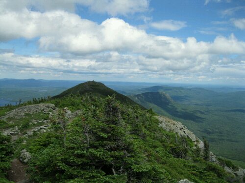
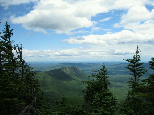
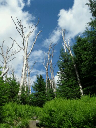
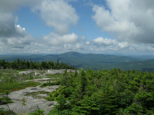
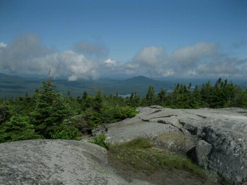
Location: Bigelow Mountain Range, Maine
I was stopped for lunch and caught up with Mother Goose and Conner and Clara yesterday when the subject of the upcoming Bigelow Mountain Range came up. I hadn’t read to far ahead in the data book and have just been rolling with whatever comes so I dind’t know what was ahead.
Mother Goose said “She misses the Bigelows like a bad hernia operation” That was my first clue something significant lay ahead:) She talked about the ups and downs, false summits and the “bouldering”
After hearing the word “bouldering” I had flashbacks of Katadihn and the difficulties I had with bouldering there. I immediately jumped up from lunch, said goodbye and headed back on the trail anxious to get as much done before the Bigelows as possible.
I managed to get within 4 miles of the first of the mountains Little Bigelow and camped for the night.
I looked at the data book to see what lay ahead. The Bigelows were a series of peaks with 2 rising over 4000′. There are campsites between Little Bigelow and Bigelow Mountain as well as the 2 main peaks of Bigelow Mountain. Most people would split the range up into 2 days and camp somewhere in the peaks.
It’s been cold here in Maine at night, dipping to the low 40’s and I have had some trouble staying warm as I was not expecting it. Having a hammock doesn’t help either as your back is exposed to the cold air. Needless to say I wasn’t excited at the idea of camping at altitude. Not to mention the crowds at these campgrounds.
I contemplated the possibility of covering the entire range in one day. It would mean over 18 miles total, 4 peaks total, lots of bouldering, topped by a 5 mile run into town. It seemed nearly impossible but I woke up at 6 to hit the trail and give it a shot.
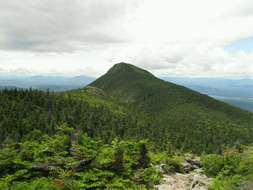
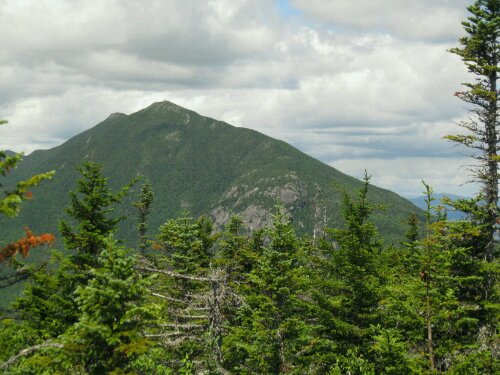
I started out heading up Little Bigelow early. I reached the summit by 10:30 with little trouble and had some new found confidence in my improving physical condition. I looked across at Bigelow Mountain. It was certainly the highest mountain I had seen since Katadihn and the bouldering looked formidable.
I tried to estimate if I could cover it all in one day and thought I probably could. All I could do was try and if I couldn’t finish I could suck it up and camp at altitude. As I headed through the pass between the 2 peaks and came closer to Bigelow Mountain I saw the enormity of it and my new found confidence was wavering.
I pressed on just focusing on the task ahead. It was a physically difficult climb to the first peak of Bigelow. There was plenty of bouldering but it was not what I would call technical. I handled it well and summitted around 2.
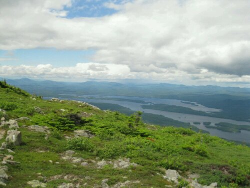
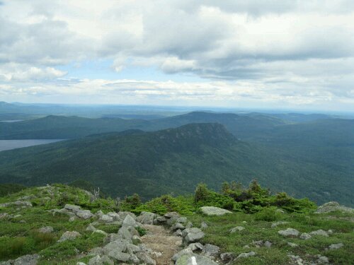
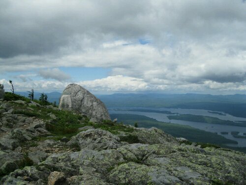
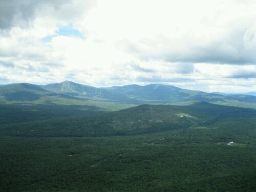
It was amazing up there!!! The views were stunning. It was freezing cold and the winds were very high. I looked across to Bigelows second peak and realized there was another peak past it I would also have to summit to get out to town.
I headed out to the west peak. It was a long greulling up and down but I managed to summit the West Peak and the South Horn peak and headed down and the 5 miles to highway 27.
Once at the highway I called a number of a hotel I had been given and got a ride in and a room. I am in Stratton, Maine and in time for Saturday’s Germany vs Argentina World Cup game!!!:) I think this could be the best game of the event so I am very excited.
I am sore all over but after doing the Bigelow range on one day I’d say I might be getting in decent shape! Now if I could stop falling on my but in the rain.
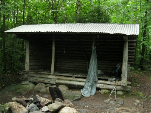
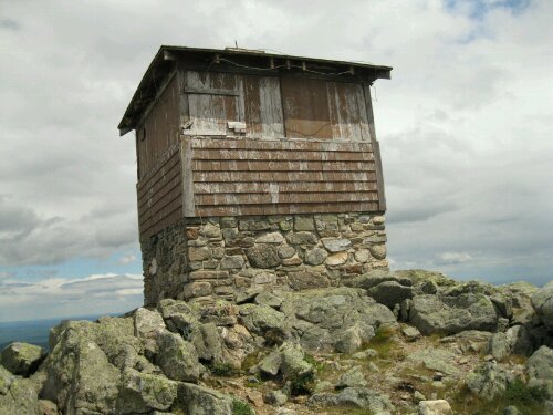
A “Lean To” or “Shelter” is a 3 walled structure generally made of logs with a metal roof.
They are usually built near reliable water sources and have privy’s as well. Most hikers camp in these.
I think they are pretty disgusting. They are known to have rodent problems. Thrill Billy said he woke up with a mouse running across his face and into his sleeping bag the other night in one.
I do not camp in them but have Hung out in them once or twice seeking temporary shelter from the rain. Even if I camp near one I hammock.
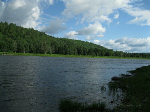
Date: 6.30.2010
Location: Kenebec River Caratunk, Maine
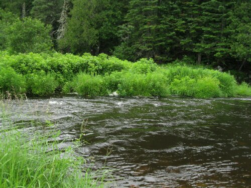
The Kenebec River is the only water crossing the trail makes in Maine that they don’t let you ford.
There are hydro powered plants upstream that release large amounts of water and the river levels rise quite rapidly.
I have been told that prior to 1985 they did let people cross on their own but that year a woman drowned crossing it. So now they have a “ferry” service (guy with a canoe). It’s tricky though cause it only runs from 9-11am except from July 15th-Sept. When they add 2 more hours to accomodate for increased hiker traffic. If you miss it your stuck that side of the river till next day.
I hiked my longest day last night (19 miles & 2 mountains) so I could camp close to the river to be sure and not miss the ferry. Beautiful river.
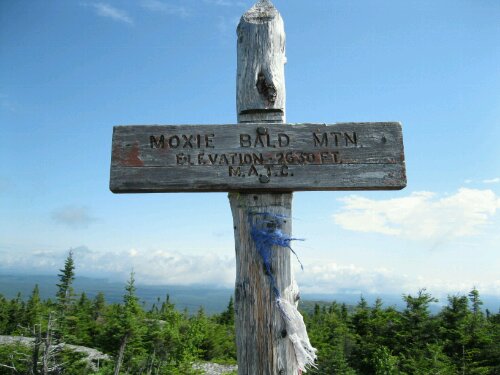
Date: 6.29.2010
Location: Moxie Bald Mountain, Maine
Date: 6.28.2010
Location: Monson, ME
My stay in Monson was great. I stayed at Shaws hostel. Dick, Dawn and Dana were the staff and they were great!
I was able to rest, watch World Cup. A few of us chipped in and had Dick drive us to Greenville, Maine near Moosehead Lake to go to a decent grocery store and a Northern Outfiters gear shop. I had to buy a new water pump. A little upset mine broke after only 1 weeks use but happy I for something much lighter.
Headed back to a sopping wet trail. A few I’d us left Shaws together and all thought despite the rain we could easily make 15 miles. The maps some had showed the terrain as flat so it seemed like an easy day despite the rain.
There is nothing like hiking in the pouring rain to drag down your spirits. At first you try to keep your feet dry, hopping on rocks, stepping on the sides etc. After you slip a few times and your feet are drenched you kinda give up and just slop right along.
I crossed 4 or 5 streams and small rivers. Again at first you take off your socks and boots and put on your river shoes, but after a while I didn’t even bother. One stream (photo above) was waist deep with some very strong currents. It was tough not to get swept down stream. My Treking poles were a great help.
I have at least learned to keep a dry set of clothes in a zip lock bag so I always have something clean and dry to sleep in even if it means putting wet clothes back on the next morning (yuk!!!)
On a brighter note Mother Goose says there are no water crossings on the trail after Maine:)
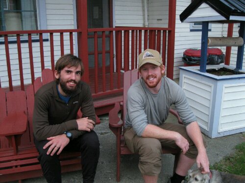
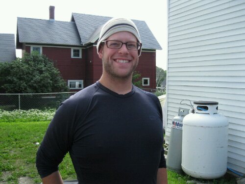
From: Virginia
(David on left Mike on right)
SOBO Thru-Hikers
Met these 2 brothers about 2 days before hitting Monson. They are really cool and about the 2 fastest south bounders we have seen on the trail. They have done quick 25 mile days even in the rugged terrain of Maine!
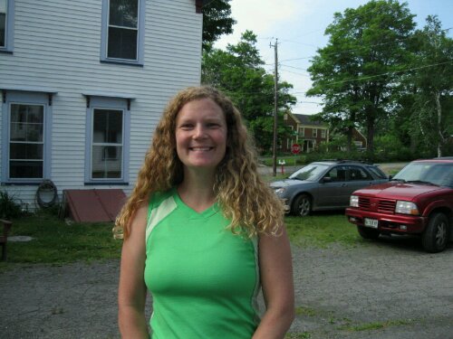
From: Columbus, Ohio
First met Lisa and CC Rider. on the decent down from Katadihn. They were headed up with Mother Goose. and I was going down. Didn’t talk much then cause I was sweating the climb down. Have seen them several times since including in town at Monson. They are very cool.
From: Columbus, Ohio
Met CC and Lisa. on the decent down from Katadihn. They were headed up with Mother Goose. Have run into them several times since including in town in Monson. They are very cool people!